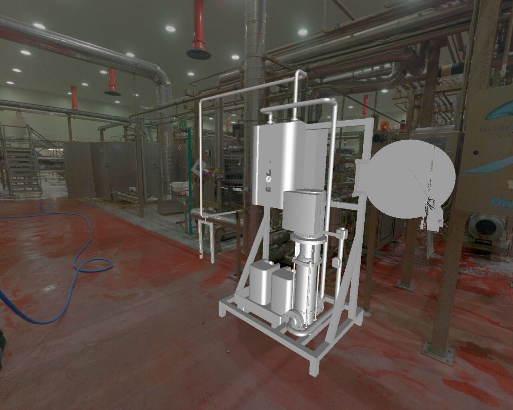
3D Laser Scanning (3D Mapping) is the non-intrusive process by which a laser scanner is used to capture data of a site at multiple locations. This data is then used to produce a point cloud data set of the entire scan site. This state-of-the-art method gives extremely accurate data with a tolerance of just 2mm. This data is then used in various scenarios to provide, time and cost savings, to process plant.
Applications of 3D Scanning
Provide highly accurate 2D and 3D Drawings
Provide 3D ‘walk throughs’
Comply with plant safety and legal requirements with mapping of Plant Assets for Emergency Services & Maintenance Teams
Architectural & Asset Documentation
Virtual design for proposed plant upgrades, extensions and refits
Benefits of 3D Scanning
Highly Accurate (within 2mm)
Fast surveys save time on site
Confined, hazardous or inaccessible areas surveyed
Scans can be taken day or night to suit your plant schedule
Digitize your plant to log plant assets and positions for permanent reference
Digital planning lowers the risk of design error for proposed changes to site structures and pipework
Data can be shared easily between all personnel with the required software
Physical visualization of proposed changes to plants
We use cookies to ensure that we give you the best experience on our website. If you continue to use this site we will assume that you are happy with it.